Whether you’re an insurance company managing claims at scale or a homeowner documenting your own property, insurance claim documentation from SkyyTask connects you with an FAA-verified local drone pilot to capture the aerial evidence you need — fast, accurate, and properly licensed.
For Homeowners and Property Owners
Proactively document your property’s condition to support your insurance claim. Independent aerial imagery gives you a clear, time-stamped record of damage — helping validate the timing, location, and extent of the loss, and giving you stronger footing if your insurance claim is disputed or underpaid.
For Insurance Companies and Adjusters
Get consistent, high-quality aerial insurance documentation across your claims pipeline without maintaining an in-house drone program. SkyyTask’s nationwide pilot network means faster turnaround on catastrophe surges, remote properties, and hard-to-access sites — giving your team reliable insurance claim documentation wherever the claim is filed. This is particularly valuable during catastrophe events, when adjuster capacity is stretched thin and property owners are waiting on claims. A nationwide pilot network means documentation doesn’t have to wait for an adjuster’s schedule to open up.
SkyyTask pilots deliver: Aerial Insurance Documentation
- High-resolution aerial photos documenting the full extent of damage
- Video footage supporting your claim or case file with clear visual evidence
- Both thermal and non-thermal imaging, depending on what’s needed
- Fast turnaround to help keep your claim or workflow moving
- Nationwide coverage — connect with a licensed local operator wherever the property is located
Every pilot on SkyyTask is cross-verified against the FAA Airmen database before accepting a job. Note: some states have specific licensing requirements for drone operators performing official insurance adjusting work — SkyyTask pilots provide aerial insurance documentation services, and clients are responsible for confirming compliance with any state-specific requirements for their particular use case.
Why Aerial Documentation Strengthens a Claim
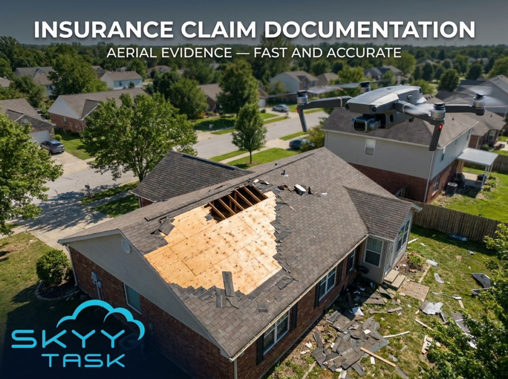
Ground-level photos often can’t capture the full scope of damage, especially on roofs, upper stories, or large properties. Aerial insurance documentation gives adjusters and homeowners a complete, time-stamped view that’s harder to dispute — showing the true extent of damage from angles a phone camera on the ground simply can’t reach. This kind of documentation can also speed up claim processing, since adjusters have clearer evidence to work from the first time, reducing the need for a second site visit.
What to Document After Property Damage
Timing matters when it comes to your insurance claim documentation. Capturing aerial photos and video as soon as possible after a storm, fire, or other damage event creates a clear record before cleanup, temporary repairs, or further weather exposure changes the condition of the property. This is especially useful for roof damage, which is often difficult to see or photograph accurately from the ground, and for large properties where a full walk-around on foot doesn’t capture the complete picture.
A drone pilot can document the full roofline, siding, surrounding structures, and any visible damage to the property in a single flight, giving you a comprehensive record rather than a handful of ground-level photos. This kind of documentation is useful whether you’re filing an initial claim, responding to a request for additional evidence, or appealing a claim that was underpaid.
Nationwide Coverage for Every Claim
From single-property homeowner claims to large-scale catastrophe response, SkyyTask’s nationwide network of FAA Part 107 certified pilots means you can get professional aerial documentation wherever the property is located. Whether you’re handling one claim or managing volume after a major weather event, SkyyTask scales to match what you need.
Ready to book? Post your job for free and connect with Part 107-certified pilots ready to provide insurance claim documentation for your property or claim. It’s free to join, free to post a job, and free to connect with certified drone pilots nationwide.