
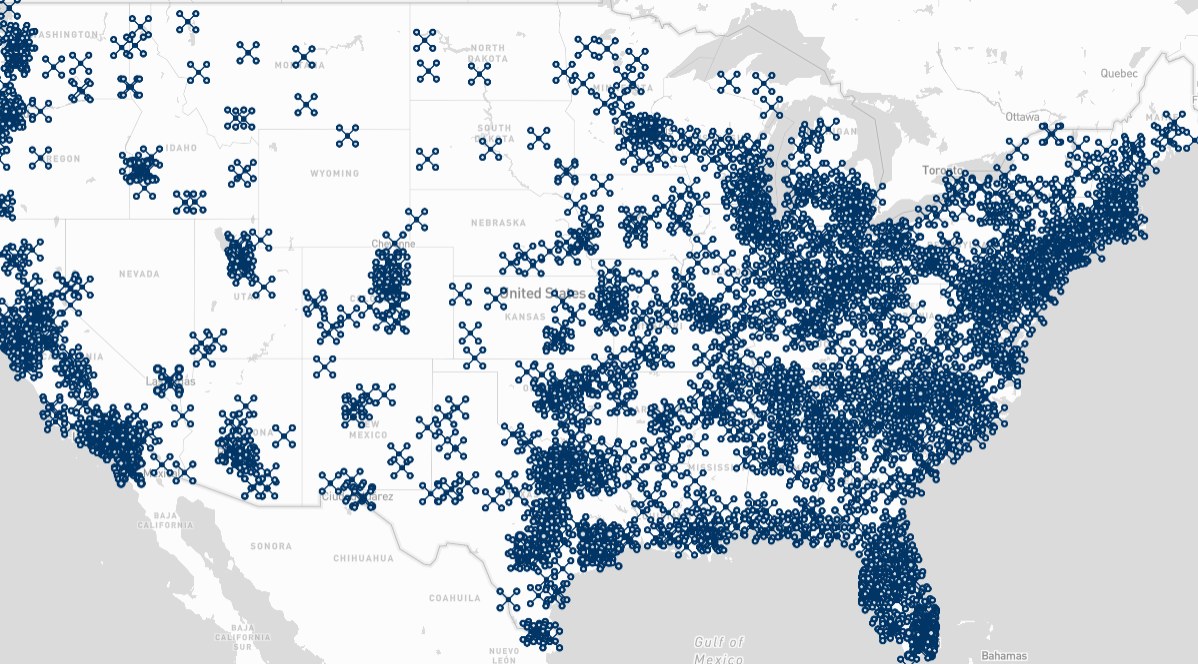
What Is the SkyyTask Pilot Locator Map?
The SkyyTask Map puts thousands of FAA-certified drone pilots on a single interactive map, so homeowners, insurers, and businesses can find local coverage in seconds. Instead of cold-calling pilots one by one, you simply search your city or zip code and see who’s nearby.
Every pilot shown on the Pilot Locator Map is active in the SkyyTask network and ready to take on new jobs in your area.
SkyyTask is a native iOS and Android app, with pilots covering all 50 states, so you can search, post a job and hire from your phone or on the web.
How the Pilot Locator Map Works
The map pulls live location data from every active pilot in the SkyyTask network. Search by city, state, or zip code, and the map instantly narrows down to the pilots closest to your project site.
Each result shows a pilot’s general service area rather than an exact address, so your search stays fast without exposing anyone’s personal details.
Search by City, State, or Zip Code
Type in a location and the Pilot Locator Map filters results within your chosen radius. Expand or shrink that radius at any time to see more — or fewer — nearby pilots.
See Coverage Across All 50 States
Because the map tracks pilots nationwide, you can check coverage in a new market before posting a job there, whether that’s a single city or an entire region.
Who Uses the Pilot Locator Map
Real estate agents use the Pilot Locator Map to find listing photographers on short notice. Insurance adjusters use it to line up roof and storm-damage documentation before a claim deadline. Construction managers use it to track site progress without renting their own equipment or hiring a full-time pilot.
Why Businesses Use the Pilot Locator Map
Real estate teams, insurance adjusters, and construction managers all rely on the Pilot Locator Map to shorten the time between needing an aerial shot and actually getting one. Instead of vetting pilots from scratch, you start with a list of people who already cover your area.
Every pilot visible on the map has gone through SkyyTask’s pilot verification process, so the coverage you see here is coverage you can actually book with confidence.
FAA-Certified Pilots You Can Trust
All pilots listed through the Pilot Locator Map hold a valid FAA Part 107 remote pilot certificate, the federal license required to fly commercially in the United States. That means every match on the map is qualified to legally complete paid drone work.
What Happens After You Find a Pilot
Once you’ve located pilots near you on the map, the next step is simple: post your job with a few details about what you need — the service type, your location, and your timeline. Nearby pilots in the SkyyTask network can then review your job and respond, so you’re choosing from people who already cover your area instead of waiting on a single quote.
There’s no cost to search the Pilot Locator Map or post a job. You only pay once you and the pilot agree on a price and lock it in. Then the work is scheduled.
Get Started With the Pilot Locator Map
Ready to find a drone pilot near you? Use the Pilot Locator Map above, review your local results, and post your job directly to the pilots who cover your area.
Still have questions about how matching works, pricing, or certification? Visit our drone pilot FAQ for answers before you get started.